|
Cape York trip by
Beach Buggy, Oct/Nov 2010 |
File = |
CapeYork2010.htm |
|
|
|
|
|
|
|
|
|
| 1.0
Introduction |
Having done this trip |
|
|
|
|
|
| several times
previously by trailbikes and |
|
|
|
|
|
| 4 WD's, it was
time to give my home built |
|
|
|
|
|
| Buggy a serious
test on a long trip. We were |
|
|
|
|
|
| constrained to
leave on 27-Oct-2010, which |
|
|
|
|
|
| would not normally be too late, getting into |
|
|
|
|
|
| the wet season,
which usually starts about |
|
|
|
|
|
| mid December
onwards. Not so this year !! |
|
|
|
|
|
| This report
will be a bit more detailed than |
|
|
|
|
|
| usual, as some
members of the Manx Dune |
|
|
|
|
|
| Buggy club
Qld., have expressed an interest |
|
|
|
|
|
| in doing this
trip sometime in 2011.Therefore |
|
|
|
|
|
| we have
included extra items which may be |
|
|
|
|
|
| useful for
future Buggy travellers to the Cape |
|
|
|
|
|
|
|
|
|
|
|
|
|
|
| 2.0 Approach
Roads, and fastest trip. |
|
|
|
|
|
| The trip up to
the Cape is approx. 2,700 km |
|
|
|
|
|
| from Brisbane,
therefore it pays to break up |
|
|
|
|
|
| the Journey by
as many interesting side |
|
|
|
|
|
| tracks as time
permits. Some of these are |
|
|
|
|
|
| described below
in the text. However, if you |
|
|
|
|
|
| are really
pressed for time, the return trip |
|
|
|
|
|
| can be done in
8 days, from Brisbane, eg :- |
|
|
|
|
|
| Brisbane-Airlie
Beach, 1 day, say 1000 km |
|
|
|
|
|
| Airlie
Beach-Cairns +, 1 day, say 700 km. |
|
|
|
|
|
| Cairn-Cape
York, 2 days, say 1000 km |
|
|
|
|
|
| Fastest one
way, say 4 days and 2,700 km. |
|
|
|
|
|
| Fastest return,
say 8 days, and 5,400 km. |
|
|
|
|
|
|
|
|
|
|
|
|
|
|
| 3.0 Preparation |
Apart from normal trip preparation, car tools,
spare parts, packing, we paid |
|
|
particular attention to the following items :- |
|
|
|
| 3.1 Ignition
leads. |
The rubber ignition caps to the Subaru EJ 22
engine were replaced, as were |
| the spark
plugs. The EJ 22 sucks moisture into the spark caps when it cools down, after
heavy |
|
| rain or
washdowns, causing one or more cylinders to misfire. We also carried a 12
volt compressor |
| with a small
diameter tube, which could be used to "blow dry" inside the spark
caps. Amazingly, |
| despite the
heavy downpours we experienced for 5 days on our return leg, we didn't get
any |
|
| ignition
failures. The plug caps were dry when inspected at home !! (couldn't believe
my eyes ?) |
|
|
|
|
|
|
|
|
|
| 3.2 Snorkel,
Dust trap, Air Cleaner |
|
|
| The previous
aircleaner for my EJ 22 lived inside |
| the engine bay
and got dirty quickly on sandy or dusty |
| tracks. The
rear wheels would send up sand/dust into |
| the engine bay,
which then required cleaning often, |
| between
services. The roads to Cape York are still very |
| sandy &
dusty, therefore I decided to install the Toyota |
| HiLux Snorkel,
dust trap, air cleaner. |
|
| This was
greatly appreciated while approaching or |
| travelling
behind vehicles, spewing up much dust. |
| It was very
easy to clean out and provided good clean |
| and cool air
for the engine. Strongly recommended ! |
| The only
problem was it caught your eye in the rear view mirror, looking like a rear
seat passenger. |
|
|
|
|
|
|
|
|
|
| 3.3 Tyres,
Wheel Bearings, Belts, hoses. |
Do a pre-trip inspection and replace suspect
items. |
| ============================================================================== |
| 3.4 Roof Cage
Loading |
All the items that it was hoped that we
wouldn't have to use, were |
| packed into the
roof cage. This included :- Spare wheel, spare petrol 10 lt., jumper leads,
snatch |
| strap + D
shackles, emergency pup tent, sleeping bags, pillows, lie down-tarp, axe,
spade. |
|
| When travelling
in the Buggy, we usually use motel/cabin accommodation as we don't have the
room |
| for comforts
such as tables and chairs, fridge, food, large stand up tent etc. Therefore,
we only pack |
| emergency
bedding/tent in case we get caught short somewhere. |
|
|
|
|
|
|
|
|
|
|
|
|
| 3.5 Sun/wind
protection |
Don't forget a light weight long sleeve shirt +
zinc cream/blockout |
| for both the
driver and passenger. It's easy to get sunburn/windburn in the tropics,
driving an open |
| top car. A bad
case of sunburn on your arms can be easy to get, driving 8+ hours. I also
found a |
| cap useful,
especially when it started to rain heavily, and water started dripping thru
the roof ! |
|
|
|
|
|
|
|
|
|
|
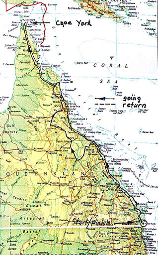
| 4.0 Route
descriptions and photos, Stage by stage.(see map above) |
|
|
|
|
|
|
|
|
|
|
|
| 4.1 Home to
Agnes Water, Town of 1770. |
Normally, we would head to Agnes Water and Town of |
| 1770, via
Cooloola Beach, Freshwater track, Maryborough, Childers, then diverting thru
Nth Burrum |
| Heads, Woodgate
and KinKuna beach to Bundaberg. This time, we were running late and had to
see |
| some friends at
Bundaberg, so headed straight to Bundy. Then we continued on, thru Rosedale
and |
| the Baffle
Creek tavern or country club (which used to be a tin shed, now a nice pub !).
Then on via |
| Deepwater
National Park and Wreck Rock (where we would usually camp) via delightful
bush tracks, |
| and on to Agnes
Water/Town of 1770.These were the last stinger free beaches in Qld. Not sure
now? |
|
|
|
|
|
|
|
|
|
|
|
|
|
|
|
|
|
|
|
|
|
|
|
|
|
|
|
|
|
|
|
|
|
|
|
|
|
|
|
|
|
|
|
|
|
|
|
|
|
|
|
|
|
|
|
|
|
|
|
|
|
| The Baffle
Creek Country Club. Used to be |
|
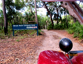
Turnoff to Deepwater National Park and |
| a tin shed, not
long ago. I've had a few here. |
|
Wreck Rock. Good camping area & beach. |
|
|
|
|
|
|
|
|
|
|
|
|
|
|
|
|
|
|
|
|
|
|
|
|
|
|
|
|
|
|
|
|
|
|
|
|
|
|
|
|
|
|
|
|
|
|
|
|
|
|
|
|
|
|
|
|
|
|
|
|
|
|
|
|
|
|
| Great track
into Wreck Rock camp area. |
|
Beach at Wreck Rock, no stingers ?? |
|
|
|
|
|
|
|
|
|
| 4.2 Agnes Water
to Airlie Beach, Bowen. |
Couldn't get a motel in Town of 1770, so drove
around |
| the area and stayed at Agnes Water, nearby.
Headed North to Airlie Beach, my old home town. |
| I had an
amazing booking on the road from Airlie to Proserpine, about 15 years ago.
There was a |
| a large boat
parked on the side of the road. The cop was hiding behind the two big
engines, radared |
| me, then stood
up and flagged me down !! Booked by a Water Police boat, me speeding on the
road? |
| ============================================================================== |
|
|
|
|
|
|
|
|
|
|
|
|
|
|
|
|
|
|
|
|
|
|
|
|
|
|
|
|
|
|
|
|
|
|
|
|
|
|
|
|
|
|
|
|
|
|
|
|
|
|
|
|
|
|
|
|
|
|
|
|
|
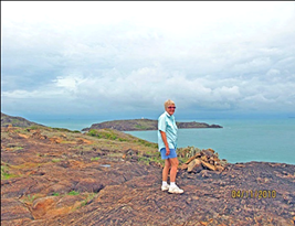
| Great lookout
on peninsula at Town of 1770. |
|
Beach at 1770. Stingers in summer now ? |
|
|
|
|
|
|
|
|
|
|
|
|
|
|
|
|
|
|
|
|
|
|
|
|
|
|
|
|
|
|
|
|
|
|
|
|
|
|
|
|
|
|
|
|
|
|
|
|
|
|
|
|
|
|
|
|
|
|
|
|
|
|
|
|
|
|
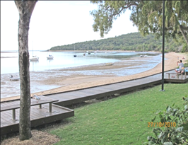
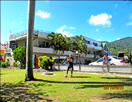
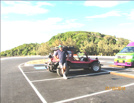
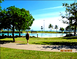
| Safe lagoon at
Airlie Beach. Used to be OK |
|
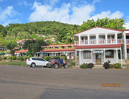
Handy motel in Airlie Beach. The town has |
| to swim
anywhere in winter, not any more. |
|
grown enormously since I lived here. |
|
|
|
|
|
|
|
|
|
|
|
|
|
|
|
|
|
|
|
|
|
|
|
|
|
|
|
|
|
|
|
|
|
|
|
|
|
|
|
|
|
|
|
|
|
|
|
|
|
|
|
|
|
|
|
|
|
|
|
|
|
|
|
|
|
|
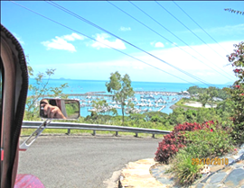
| View of
Whitsunday passage from Telstra hill. |
|
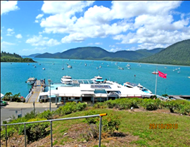
View of Shute harbour, ferry base. |
|
|
|
|
|
|
|
|
|
|
|
|
|
|
|
|
|
|
|
|
|
|
|
<-------- |
View of newer ferry terminal between |
|
|
|
|
|
Airlie Beach and Cannonvale. Another |
|
|
|
|
|
ferry terminal is being built in Muddy Bay, |
|
|
|
|
|
closer to the centre of town. |
|
|
|
|
|
|
|
|
|
|
|
|
|
|
|
Airlie Beach is a lovely town to visit, but I |
|
|
|
|
|
found living there a bit limited. Once you get |
|
|
|
|
|
sick of fishing and boating, the place loses |
|
|
|
|
|
its appeal, with hundreds of crazy young |
|
|
|
|
|
backpackers mooning around constantly. |
|
|
|
|
|
|
|
|
|
| ============================================================================== |
|
|
|
|
|
|
|
|
|
|
|
|
|
|
|
|
|
|
|
|
|
|
|
|
|
|
|
|
|
|
|
|
|
|
|
|
|
|
|
|
|
|
|
|
|
|
|
|
|
|
|
|
|
|
|
|
|
|
|
|
|
| Rose Bay,
Bowen, safe swimming, they say ?? |
Rose Bay resort, Bowen, great value, loc'n. |
| 4.3 Bowen to
Charters Towers, Mareeba, via Burdekin Dam crossing !!?? |
|
|
| From Bowen, we
headed inland to head north, to cross the Base of the Burdekin Dam. Luckily,
we |
| stopped at a
unique inland pub/farm north of Collinsville where we learned that the dam
crossing was |
| closed due to
flood water flows. We had to make long detours via Mt. Coolon and Belyando to
get |
| around the
problem. Had we headed for the dam crossing, we calculated that we would have
run out |
| of petrol, as
that route was much longer. The locals advised us that no "road
closed" signs are ever |
| put up as they
are too far from any habitation, for the Police or Council workers. |
|
|
|
|
|
|
|
|
|
|
|
|
|
|
|
|
|
|
|
|
|
|
|
|
|
|
|
|
|
|
|
|
|
|
|
|
|
|
|
|
|
|
|
|
|
|
|
|
|
|
|
|
|
|
|
|
|
|
|
|
|
|
|
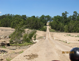
| Track towards
Burdekin dam crossing. |
|
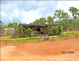
Bowen River pub/farmhouse. Good warning. |
|
|
|
|
|
|
|
|
|
|
|
|
|
|
|
|
|
|
|
|
|
|
|
|
|
|
|
|
|
|
|
|
|
|
|
|
|
|
|
|
|
|
|
|
|
|
|
|
|
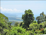
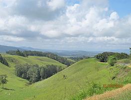
| Views near
Ravenshoe, inland from coast. |
|
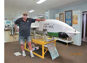
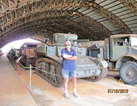
Private museum, near Mareeba. |
|
|
|
|
|
|
|
|
|
|
|
<---
Another museum display. |
|
|
|
|
|
|
|
|
|
|
|
|
|
|
|
|
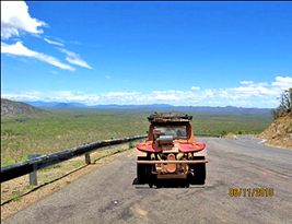
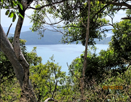
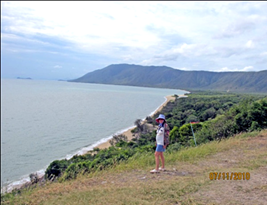
View looking down |
|
|
|
|
escarpment towards |
|
|
|
|
Port Douglas-------> |
|
|
|
|
|
|
|
|
|
|
|
|
| ============================================================================== |
| 4.4 Port
Douglas to Cooktown, via Captain Cook hwy, Cape Tribulation and Bloomfield
track. |
| The coast road
from Pt. Douglas to Cooktown via Cape Tribulation is a "must do"
track. The views |
| are fantastic
and the roads have been improved considerably, with the 4 creek crossings
being the |
| major
impediment to 2WD vehicles. Put this one on your "bucket list". I
was a little apprehensive |
| about some of
the creek crossings drowning my engine, but no problems at all, nowadays !
All the |
| very steep
sections have been concreted and Bloomfield river now has an "all
tide" causeway. |
|
|
|
|
|
|
|
|
|
|
|
|
|
|
|
|
|
|
|
|
|
|
|
|
|
|
|
|
|
|
|
|
|
|
|
|
|
|
|
|
|
|
|
|
|
|
|
|
|
|
|
|
|
|
|
|
|
|
|
|
|
|
|
|
|
|
|
| Daintree river
ferry. |
|
|
|
Bloomfield river causeway. No problem now. |
|
|
|
|
|
|
|
|
|
|
|
|
|
|
|
|
|
|
|
|
|
|
|
|
|
|
|
|
|
|
|
|
|
|
|
|
|
|
|
|
|
|
|
|
|
|
|
|
|
|
|
|
|
|
|
|
|
|
|
|
|
| Bloomfield
river, many good bush camps. |
|
Lions Den pub, another famous bush icon ! |
|
|
|
|
|
|
|
|
|
|
|
|
|
|
|
|
|
|
|
|
|
|
|
|
|
|
|
|
|
|
|
|
|
|
|
|
|
|
|
|
|
|
|
|
|
|
|
|
|
|
|
|
|
|
|
|
|
|
|
|
|
| Good value
motel, Cooktown. |
|
|
Captain Cook's lookout hill, Cooktown. |
|
|
|
|
|
|
|
|
|
|
|
|
|
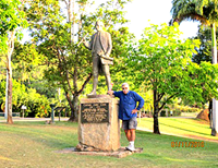
<---------- |
Statue of Captain Cook, Cooktown. |
|
|
|
|
|
Cooktown caters well for tourists, good |
|
|
|
|
|
value food, accommodation, museums etc. |
|
|
|
|
|
Could spend a day or two here. |
|
|
|
|
|
|
Last chance for major repairs or spare parts |
|
|
|
|
|
before hitting Cape Development tracks. |
|
|
|
|
|
I said tracks, which are now good quality |
|
|
|
|
|
gravel roads, millions having been spent. |
| ============================================================================== |
| 4.5 Cooktown to
Archer River Roadhouse, via Lakeland, Laura, Musgrave, Coen. |
|
| The road from
Cooktown to Lakeland (and to Cairns) is now all weather and paved. The gravel
roads |
| north to Archer
river are superb quality, millions have been spent. Petrol supply is no
problem. |
|
|
|
|
|
|
|
|
|
|
|
|
|
|
|
|
|
|
|
|
|
|
|
|
|
|
|
|
|
|
|
|
|
|
|
|
|
|
|
|
|
|
|
|
|
|
|
|
|
|
|
|
|
|
|
|
|
|
|
|
|
|
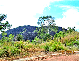
| Black mountain,
near Cooktown. |
|
|
Laura roadhouse. |
|
|
|
|
|
|
|
|
|
|
|
|
|
|
|
|
|
|
|
|
|
|
|
|
|
|
|
|
|
|
|
|
|
|
|
|
|
|
|
|
|
|
|
|
|
|
|
|
|
|
|
|
|
|
|
|
|
|
|
|
|
|
|
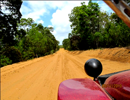
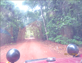
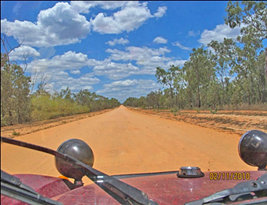
| Typical gravel
road, go for your life. Only dust, |
|
Sexchange hotel Coen, Melb. Cup Day. |
| roadworks, or
the boss, can slow you down ! |
|
People often photographed/admired my car. |
|
|
|
|
|
|
|
|
|
|
|
|
|
|
|
|
|
|
|
|
|
|
|
|
|
|
|
|
|
|
|
|
|
|
|
|
|
|
|
|
|
|
|
|
|
|
|
|
|
|
|
|
|
|
|
|
|
|
|
|
|
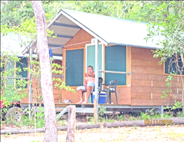
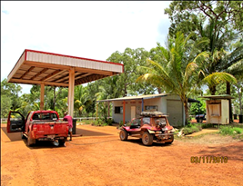
| Archer River
rooms, $120/ nite and no A/C ? |
|
Pump girls dressed up nicely for Melb. Cup. |
|
|
|
|
|
|
|
|
|
|
|
|
|
|
|
|
|
|
|
|
|
|
|
|
|
|
|
|
|
|
|
|
|
|
|
|
|
|
|
|
|
|
|
|
|
|
|
|
|
|
|
|
|
|
|
|
|
|
|
|
|
|
|
|
|
|
|
|
|
|
|
|
|
|
|
|
|
|
|
|
|
|
|
|
|
|
|
|
|
|
|
|
|
|
|
|
|
|
|
| Archer River
roadhouse, all facilities + camping. |
Flowing water in Archer river, rare sight ? |
| ============================================================================== |
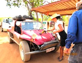
| We caused a
small sensation at Archer River roadhouse, when we arrived on Melb. Cup day.
There |
| were many
tourists there and they gathered around in droves, looking at and
photographing the |
| Buggy.
(including some Yanks) The pump girls were all done up with high heels, hats,
nice dresses. |
|
|
|
|
|
|
|
|
|
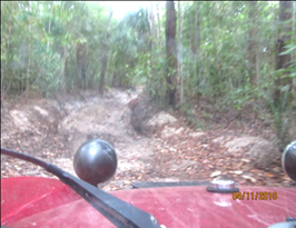
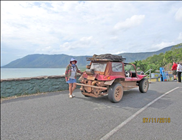
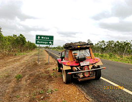
| 4.6 Archer
River to the Top, Punsand Bay Resort. |
|
|
|
|
| The next
section, from Archer river to the top, via Wenlock, Bramwell, Jardine used to
be a very bad |
| 2 wheel track.
Now, its easy going all the way, with reliable petrol at Bramwell and Jardine
river. |
|
|
|
|
|
|
|
|
|
|
|
|
|
|
|
|
|
|
|
|
|
|
|
|
|
|
|
|
|
|
|
|
|
|
|
|
|
|
|
|
|
|
|
|
|
|
|
|
|
|
|
|
|
|
|
|
|
|
|
|
|
| The Bamaga
turnoff. Easy going. |
|
|
View of Wenlock river from new bridge. |
|
|
|
|
|
|
|
|
|
|
|
|
|
|
|
|
|
|
|
|
|
|
|
|
|
|
|
|
|
|
|
|
|
|
|
|
|
|
|
|
|
|
|
|
|
|
|
|
|
|
|
|
|
|
|
|
|
|
|
|
|
|
|
|
|
|
|
|
|
|
| Bramwell
roadhouse, fuel and food. |
|
This used to be 2 wheel tracks. |
|
|
|
|
|
|
|
|
|
|
|
|
|
|
|
|
|
|
|
|
|
|
|
|
|
|
|
|
|
|
|
|
|
|
|
|
|
|
|
|
|
|
|
|
|
|
|
|
|
|
|
|
|
|
|
|
|
|
|
|
|
|
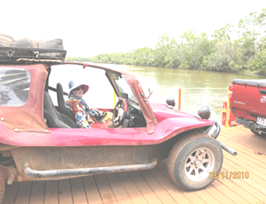
| Jardine ferry
roadhouse. $88 return for ferry. |
|
The alternative ford has been dug deep !!?? |
|
|
|
|
|
|
|
|
|
| The Punsand Bay
resort, very close to the top, is a delightful place with all facilities,
including cabins, |
| on site tents,
camp sites, food, booze, swimming pool and is located beside the sea, within
sight of |
| the tip of Cape
York. There is a short cut, from Punsand Bay to the tip, about 7 km., which
is one of |
| the last
challenging tracks on this trip. Could be difficult to pass other cars here.
You need pretty |
| high clearance
here to get over rocks and ruts caused by water. Felt more like old times
here ! |
|
| There is a
longer, alternative route to the tip, for low clearance vehicles. The superb
old Pajinka |
|
| resort, right
near the tip, was trashed by the locals and is still closed. $20 million just
wasted ? |
|
| ============================================================================== |
| 4.7 At the top,
Tip of Cape York, Somerset, and then it began to pour down in buckets !! |
|
|
|
|
|
|
|
|
|
|
|
|
|
|
|
|
|
|
|
|
|
|
|
|
|
|
|
|
|
|
|
|
|
|
|
|
|
|
|
|
|
|
|
|
|
|
|
|
|
|
|
|
|
|
|
|
|
|
|
|
|
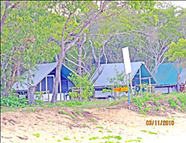
| Punsand Bay
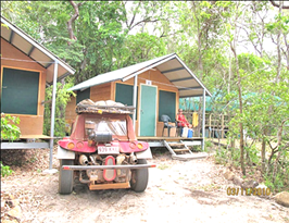
cabins, camping available also. |
|
View from cabin, looking north. |
|
|
|
|
|
|
|
|
|
|
|
|
|
|
|
|
|
|
|
|
|
|
|
|
|
|
|
|
|
|
|
|
|
|
|
|
|
|
|
|
|
|
|
|
|
|
|
|
|
|
|
|
|
|
|
|
|
|
|
|
|
|
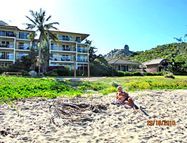
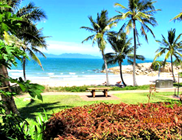
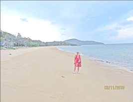
| Beach at
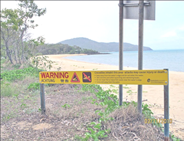
Punsand Bay, look out for crocs, stingers ! |
Onsite tents, as good as cabins, available. |
|
|
|
|
|
|
|
|
|
|
|
|
|
|
|
|
|
|
|
|
|
|
|
|
|
|
|
|
|
|
|
|
|
|
|
|
|
|
|
|
|
|
|
|
|
|
|
|
|
|
|
|
|
|
|
|
|
|
|
|
|
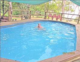
| Safe swimming
at Punsand Bay. |
|
|
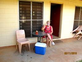
Parj testing esky. Cabins had 24hr. Power. |
|
|
|
|
|
|
|
|
|
|
|
|
|
|
|
|
|
|
|
|
|
|
|
|
|
|
|
|
|
|
|
|
|
|
|
|
|
|
|
|
|
|
|
|
|
|
|
|
|
|
|
|
|
|
|
|
|
|
|
|
|
| Croc and
stinger warning signs, don't ignore. |
|
Short cut track, Punsand Bay to tip, 7km. |
| I've swum here
often after motorcycle trips |
|
You need high clearance and I reckon lower |
| but the locals
say don't go too far out. |
|
your tires to 10-15 psi if sand is dry. |
| ============================================================================== |
|
|
|
|
|
|
|
|
|
|
|
|
|
|
|
|
|
|
|
|
|
|
|
|
|
|
|
|
|
|
|
|
|
|
|
|
|
|
|
|
|
|
|
|
|
|
|
|
|
|
|
|
|
|
|
|
|
|
|
|
|
| Tip walk
parking area, then 20 minute walk to top. |
Great views, look at the rain building up? |
|
|
|
|
|
|
|
|
|
|
|
|
|
|
|
|
|
|
|
|
|
|
|
|
|
|
|
|
|
|
|
|
|
|
|
|
|
|
|
|
|
|
|
|
|
|
|
|
|
|
|
|
|
|
|
|
|
|
|
|
|
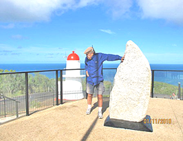
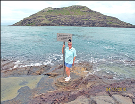
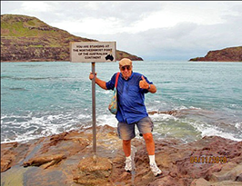
| The TOP marker.
Islands in the background. |
|
Good one Yollie, well done. Rain coming ! |
|
|
|
|
|
|
|
|
|
|
|
|
|
|
|
|
|
|
|
|
|
|
|
|
|
|
|
|
|
|
|
|
|
|
|
|
|
|
|
|
|
|
|
|
|
|
|
|
|
|
|
|
|
|
|
|
|
|
|
|
|
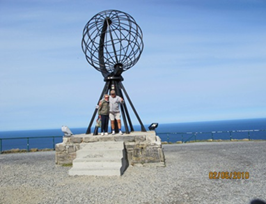
| The
"other" North Cape in Norway, we were |
|
Track to Somerset. Old track was very deep |
| there in June
this year. Two out of 2, in 1 year ! |
& narrow with track sides at window height
! |
|
|
|
|
|
|
|
|
|
|
|
|
|
|
|
|
|
|
|
|
|
|
|
|
|
|
|
|
|
|
|
|
|
|
|
|
|
|
|
|
|
|
|
|
|
|
|
|
|
|
|
|
|
|
|
|
|
|
|
|
|
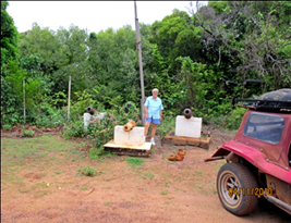
| Jardine
memorial, Somerset. Some cannons, |
|
And now the rains started. Filled the floor |
| markers and
graves. This used to be a very |
|
before we got the side curtains on. Visibility |
| difficult,
narrow, steep track, hard to pass others. |
was bad, and slipped around a bit ! |
| ============================================================================== |
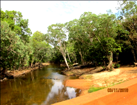
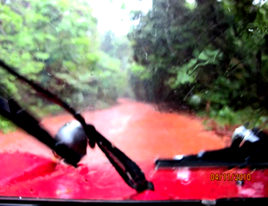
| 4.8 Return
trip, from TOP to home. |
Because if was mostly raining so hard, we could
not |
| take many
photos, or do some more side trips on the way home. We were concerned about
losing |
| spark to the
engine, and were more or less in survival mode. Some may question why we
didn't take |
| the more
difficult "Telegraph track" coming up or going down. Some sections
on this track, used to |
| have some deep
and long creek crossings, and since we were alone, we were reluctant to get
stuck, |
| towards the end
of the season, with little traffic on the roads. The bonnet of my 4WD has
gone under |
| water on some
of these crossings, and I've had to push my motorbikes across with the
engines off ! |
| This track may
have been improved, but I was unable to confirm any current track conditions. |
|
| We ended up
taking the most direct way home, including the Captain Cook hwy, Pt Douglas
to |
|
| Cairns. At one
section, after Miriam Vale, it rained so hard it was dangerous to keep
driving or even |
| stop !! I
managed a leg of 375 km., using 34.5 litres of petrol. Tank capacity was 34.8
I believe ?? |
|
|
|
|
|
|
|
|
|
|
|
|
|
|
|
|
|
|
|
|
|
|
|
|
|
|
|
|
|
|
|
|
|
|
|
|
|
|
|
|
|
|
|
|
|
|
|
|
|
|
|
|
|
|
|
|
|
|
|
|
|
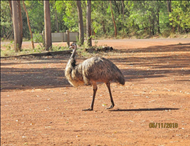
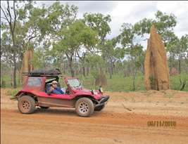
| Termite nest,
in between showers. |
|
|
Emu at Hahn River roadhouse, good one. |
|
|
|
|
|
|
|
|
|
|
|
|
|
|
|
|
|
|
|
|
|
|
|
|
|
|
|
|
|
|
|
|
|
|
|
|
|
|
|
|
|
|
|
|
|
|
|
|
|
|
|
|
|
|
|
|
|
|
|
|
|
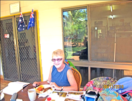
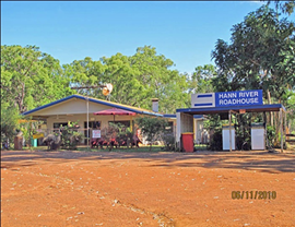
| Good roadhouse,
friendly, has everything. |
|
Yollie with parrot on shoulder at Hahn river. |
|
|
|
|
|
|
|
|
|
|
|
|
|
|
|
|
|
|
|
|
|
|
|
|
|
|
|
|
|
|
|
|
|
|
|
|
|
|
|
|
|
|
|
|
|
|
|
|
|
|
|
|
|
|
|
|
|
|
|
|
|
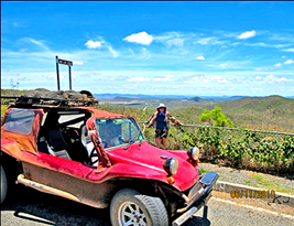
| Good road from
Lakeland to Cairns, via |
|
Get some spectacular views on the high |
| Palmer river
and Mt., Carbine. |
|
|
points at both ends. Short "break"
from rain. |
|
|
|
|
|
|
|
|
|
| Mt Carbine used
to have a cow (or bull ?) |
|
Palmer River roadhouse or Mt Carbine both |
| which walked
into the pub, bludging beer. |
|
have accommodation and camping, food and |
| I kid you not,
I've had to move away from it. |
|
booze. |
|
|
|
| ============================================================================== |
|
|
|
|
|
|
|
|
|
|
|
|
|
|
|
|
|
|
|
|
|
|
|
|
|
|
|
|
|
|
|
|
|
|
|
|
|
|
|
|
|
|
|
|
|
|
|
|
|
|
|
|
|
|
|
|
|
|
|
|
|
| Captain Cook
"heritage hwy" views. |
|
More Captain Cook "heritage hwy"
views. |
|
|
|
|
|
|
|
|
|
| After Cairns,
the rain continued heavily. South of Miriam Vale, we really copped it. We
just kept |
| going, hoping
the electrics and wipers kept working, We were glad to get home in one piece. |
|
|
|
|
|
|
|
|
|
|
| Conclusions. |
Normally, this is not a difficult trip, just
long. Therefore, it is worthwhile doing |
|
|
some side tracks on the way up and back, if you
have the time available. |
|
|
This trip, the rains came earlier than normally
expected, but the Buggy and |
|
|
its equipment, the canopy, spark plugs, wipers
and suchlike worked OK. Any |
|
|
preparation or preventative maintenance is
offcourse strongly recommended. |
|
|
|
|
|
|
|
|
|
| Timing of trip |
The roads are open from late April till mid
December usually. Try and avoid the |
|
|
school holidays as traffic is heavy, resulting
in pressure on accomodations & |
|
|
could result in delays at the Jardine ferry.
(they only work to rules, if that) |
|
|
|
|
|
|
|
|
|
| Itineraries and |
I have not included itineraries or costing
details, as at our age, we need to |
| Costings |
|
travel in some comfort and stay in motels when
travelling in the Buggy. |
|
|
|
Also, most younger guys could do 1000 km., per
day, on the approach roads. |
|
|
We generally prefer say 400 to 650 km., max,
depending on circumstances. |
|
|
Our itineraries and costings are available to
anyone, if they are interested. |
|
|
|
|
|
|
|
|
|
| Travelling in |
When travelling behind other vehicles, you need
to be a fair way behind to |
| convoy |
|
avoid the dust. This could make it difficult
when travelling in convoy, as the |
|
|
cars would be spaced far apart. Maybe UHF
radios could be useful here ? |
|
|
|
|
|
|
|
|
|
| Mobile phones |
North of Cooktown, mobile phones only worked at
Coen and Punsand Bay. |
| and radio |
|
We got good ABC radio at Punsand Bay. Has
anyone tried to get a car radio |
|
|
to work in a Beach Buggy ? I suspect earphones
could be dangerous ? |
|
|
We have to shout to talk to each other when
motoring above 60 kph. |
|
|
|
|
|
|
|
|
|
|
| Petrol |
|
If your Buggy has a range of 300km., you
shouldn't need to use your |
|
| availability |
|
emergency petrol. I went over this by choice,
since it was raining hard, and |
|
|
got away with it. We were getting 11 km./ lt.,
most times. |
|
|
|
|
Maximum range I got was 375 km., driving
carefully in heavy rain ! |
|
|
|
|
|
|
|
|
|
|
| Maps & Sat
Nav. |
The RACQ maps, for all Qld.+ detail maps of
coastal sections and Cape York |
|
|
are all you need. If you use a Sat Nav, make
sure it is securely fixed to the |
|
|
car by screws or glue. There are still plenty
of corrugations to shake it loose. |
|
|
|
|
|
|
|
|
|
| Useful Link to
a |
The Manx Dune Buggy Club of Qld., has an
extremely good website for Buggy |
| good Buggy
website. |
owners and builders. They have about 500
members, in Australia & overseas. |
|
|
Anyone reading this report, will find their
following website very interesting :- |
|
|
www.manxclub.org/ |
|
|
|
|
|
| ===================================================================== |
END |
|
|
|
|
|
|
|
|
|