| page 1 |
|
|
File = |
Perth07 |
|
|
|
|
|
|
|
|
|
|
|
|
|
|
|
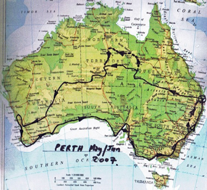
| Map |
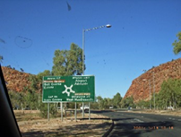
Perth via Alice & Great Central Road,
return via coast in 4WD. |
May/Jun 2007 |
|
|
|
|
|
|
|
|
|
|
|
| Background |
|
|
|
|
|
|
|
|
| We had
postponed this trip on |
|
|
|
|
|
|
|
| several
occasions for other |
|
|
|
|
|
|
|
| commitments, so
in the Autumn |
|
|
|
|
|
|
|
| of 2007, we were determined to |
|
|
|
|
|
|
|
| complete this
trip. Australia was |
|
|
|
|
|
|
|
| experiencing
one of the worst & |
|
|
|
|
|
|
|
| longest
droughts on record, so |
|
|
|
|
|
|
|
| we were not
expecting any |
|
|
|
|
|
|
|
| problems with
rain or wet roads. |
|
|
|
|
|
|
|
| How wrong was
this expectation ! |
|
|
|
|
|
|
|
| The rain
followed us from East to |
|
|
|
|
|
|
|
| West and back
again, causing |
|
|
|
|
|
|
|
| major
diversions and changes to |
|
|
|
|
|
|
|
| planned
itineraries. (see dotted |
|
|
|
|
|
|
|
| lines on map)
There was major |
|
|
|
|
|
|
|
| flooding in the
Newcastle area & |
|
|
|
|
|
|
|
| snow on the New
England hway |
|
|
|
|
|
|
|
| peaks near
Murrurundi. |
|
|
|
|
|
|
|
| The winds were
gale force on |
|
|
|
|
|
|
|
| both the West
& East coasts, |
|
|
|
|
|
|
|
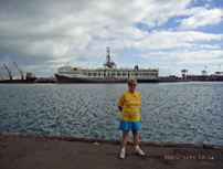
| causing a ship
to run aground on |
|
|
|
|
|
|
|
| Nobbies Beach,
Newcastle. |
|
The dotted lines show major diversions for
flooding. |
|
|
|
|
|
|
|
|
|
|
|
| Home to Boulia |
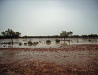
Heading West, via Roma, Charleville, Quilpie,
Windorah, Bedourie, Boulia. |
|
| A well known
section, previously used for Simpson Desert trips. The rain started near
Charleville |
|
| and past
Windorah, were long sections of gravel road with 150mm + water on the track.
Because |
|
| these sections
were so flat, the water had difficulty in flowing away, leaving slippery
conditions. |
|
|
|
|
|
|
|
|
|
|
|
|
|
|
|
|
|
|
|
|
|
|
|
|
|
|
|
|
|
|
|
|
|
|
|
|
|
|
|
|
|
|
|
|
|
|
|
|
|
|
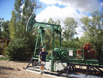
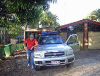
| Departure
photo, at home. |
ROMA oil well. |
|
Heading West, rain imminent. |
|
|
|
|
|
|
|
|
|
|
|
|
|
|
|
|
|
|
|
|
|
|
|
|
|
|
|
|
|
|
|
|
|
|
|
|
|
|
|
|
|
|
|
|
|
|
|
|
|
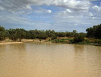
| Water beside
the tracks. Very |
Coopers Creek, seldom seen |
Going past Birdsville turnoff, |
|
| flat, little
drainage ! |
|
it so full. |
|
|
heading N-West to Boulia |
|
| ======== |
======== |
======== |
======== |
======== |
======== |
======== |
======== |
======== |
|
| page 2 |
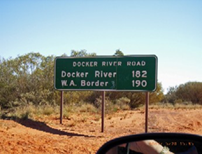
Boulia, Qld to WA, via Ayers Rock or Uluru,
Docker River, |
|
|
|
| The weather,
strong winds & rain, water on the tracks, were not conducive to camping
out, which we |
|
| prefer to
staying in motels. Our camp set up and pull down, together with our
equipment, is so well |
|
| organised that
we can prepare or demolish our camp in about 30 minutes, without undue rush. |
|
|
| On this trip
however, we stayed mostly in motels. Departing Boulia, our intention was to
take the |
|
| Plenty Hwy to
Alice Springs. Just as we arrived at the Donahue/Plenty hwy turnoff, the
Police were |
|
| putting up the
barriers to close the road because of flooding. This did not surprise us,
going by the |
|
| water on the
tracks the previous day & the continuing rainfall. Had no choice but to
take a 1,500 km |
|
| detour, via Mt.
Isa, Barkley homestead, Tennant Ck., to Alice Springs. The consequences of |
|
|
| getting caught
in flat floodland are too horrible to contemplate by risking any such attempt
! |
|
|
|
|
|
|
|
|
|
|
|
|
|
|
|
|
|
|
|
|
|
|
|
|
|
|
|
|
|
|
|
|
|
|
|
|
|
|
|
|
|
|
|
|
|
|
|
|
|
|
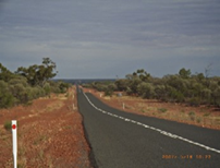
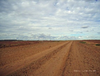
| Tracks to
Bedourie, dry section. |
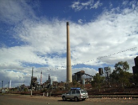
Mt. Isa smoke stacks. |
|
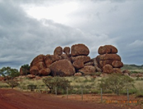
Devils marbles, North of Alice. |
|
|
|
|
|
|
|
|
|
|
|
|
|
|
|
|
|
|
|
|
|
|
|
|
|
|
|
|
|
|
|
|
|
|
|
|
|
|
|
|
|
|
|
|
|
|
|
|
|
| Leaving Alice
Springs, via gap. |
Folded strata on Mereenie loop. |
Inside Goose Bluff meteor crater. |
|
|
|
|
|
|
|
|
|
|
|
|
|
|
|
|
|
|
|
|
|
|
|
|
|
|
|
|
|
|
|
|
|
|
|
|
|
|
|
|
|
|
|
|
|
|
|
|
|
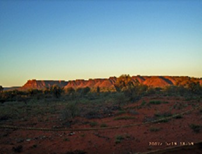
| Kings canyon at
sunset. |
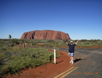
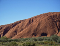
Approaching Uluru or Ayers rock. |
Walking track to top of Uluru. |
|
|
|
|
|
|
|
|
|
|
|
|
|
|
|
|
|
|
|
|
|
|
|
|
|
|
|
|
|
|
|
|
|
|
|
|
|
|
|
|
|
|
|
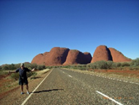
| Approaching the
Olgas. |
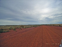
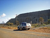
Track to WA border. Generally |
WA residents. Feral camels now |
|
|
|
|
not as bad as this looks. |
permanent "legal" residents. |
|
| ============================================================================== |
| page 3 |
Some sections in NT and WA required permits to
pass thru Aboriginal lands. These were |
|
| no problem and
were issued free of charge via Internet or by mail. Apparently these were
required |
|
| to curtail
bootleggers selling grog to community residents. |
|
|
|
|
|
| WA, Docker
River to Kalgoorlie, then the Pinnacles, the Perth, Fremantle, Bunbury. |
|
|
|
|
|
|
|
|
|
|
|
|
|
|
|
|
|
|
|
|
|
|
|
|
|
|
|
|
|
|
|
|
|
|
|
|
|
|
|
|
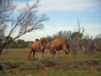
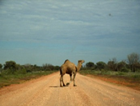
| Camel crossing,
Gt. Central Rd. |
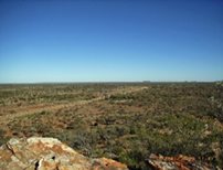
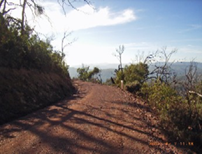
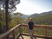
Lookout near Laverton. |
|
Great Central Road.(superhwy?) |
|
|
|
|
|
|
|
|
|
|
|
|
|
|
|
|
|
|
|
|
|
|
|
|
|
|
|
|
|
|
|
|
|
|
|
|
|
|
|
|
|
|
|
|
|
|
|
|
|
| Kalgoorlie,
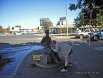
Paddy Hannan fountain. |
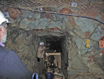
Underground mine |
Kalgoorlie water pipeline. |
|
|
|
|
|
|
|
|
|
|
|
|
|
|
|
|
|
|
|
|
|
|
|
|
|
|
|
|
|
|
|
|
|
|
|
|
|
|
|
|
|
|
|
|
|
|
|
|
|
| Kalgoorlie
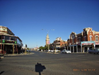
Town. |
|
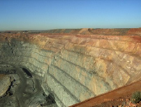
The Superpit.(thanks Bondy) |
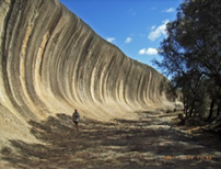
The famous wave rock. |
|
|
|
|
|
|
|
|
|
|
|
|
|
|
|
|
|
|
|
|
|
|
|
|
|
|
|
|
|
|
|
|
|
|
|
|
|
|
|
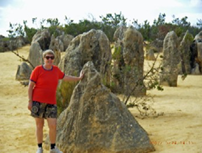
| Pinnacles, near
Cervantes, WA |
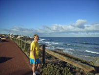
WA coast, having crossed Oz --> |
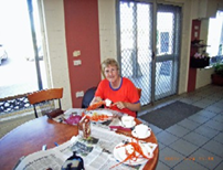
Reward, a crayfish meal !! |
|
|
|
|
|
|
|
|
|
|
|
|
|
|
|
|
|
|
|
|
|
|
|
|
|
|
|
|
|
|
|
|
|
|
|
|
|
|
|
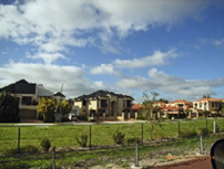
| Miners $1m
cottages, WA coast. |
|
Fremantle harbour. |
Bunbury coast, wild weather. |
|
| page 4 |
Continuing down west coast of WA, then East. |
|
|
|
|
|
|
|
|
|
|
|
|
|
|
|
|
|
|
|
|
|
|
|
|
|
|
|
|
|
|
|
|
|
|
|
|
|
|
|
|
|
|
|
|
|
|
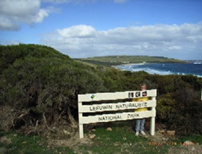
| Cape Leeuwin |
|
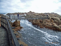
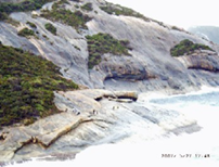
Canal Rocks |
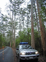
Forest--> |
|
|
|
|
|
|
|
|
|
|
|
|
|
|
|
|
|
|
|
|
|
|
|
|
|
|
|
|
|
|
|
|
|
|
|
|
|
|
|
|
|
|
|
|
|
|
|
|
|
| Rock fishermen,
near Albany |
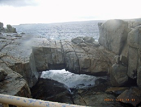
Natural bridge |
|
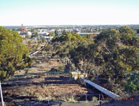
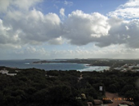
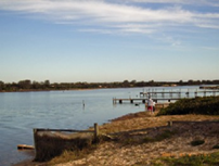
View of Esperance, great town. |
|
|
|
|
|
|
|
|
|
|
|
|
|
|
|
|
|
|
|
|
|
|
|
|
|
|
|
|
|
|
|
|
|
|
|
|
|
|
|
|
|
|
|
|
|
|
|
|
|
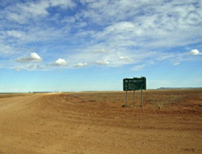
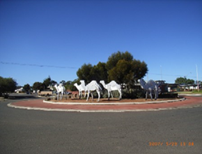
| Norseman
aluminium camels |
Tailings dump, Norseman |
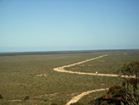
Nullarbor plain, heading East. |
|
|
|
|
|
|
|
|
|
|
|
|
|
|
|
|
|
|
|
|
|
|
|
|
|
|
|
|
|
|
|
|
|
|
|
|
|
|
|
|
|
|
|
|
|
|
|
|
|
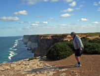
| Looking west
from Eucla |
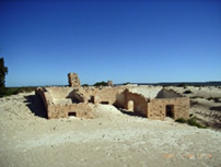
Eucla Telegraph station. |
Grt Australian bight, cliffs, west. |
|
|
|
|
|
|
|
|
|
|
|
|
|
|
|
|
|
|
|
|
|
|
|
|
|
|
|
|
|
|
|
|
|
|
|
|
|
|
|
|
|
|
|
|
|
|
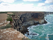
| Grt. bight
cliffs, looking East |
Seals on Eyre Peninsula. |
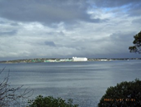
Looking at Port Lincoln. |
|
| page 5 |
Eyre Peninsula to Melbourne |
|
|
|
|
|
|
|
|
|
|
|
|
|
|
|
|
|
|
|
|
|
|
|
|
|
|
|
|
|
|
|
|
|
|
|
|
|
|
|
|
|
|
|
|
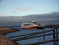
| Car Ferry,
Cowell to Wallaroo |
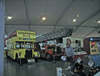
Birdwood motor museum |
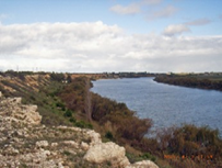
The mighty Murray, still has water |
|
|
|
|
|
|
|
|
|
|
|
|
|
|
|
|
|
|
|
|
|
|
|
|
|
|
|
|
|
|
|
|
|
|
|
|
|
|
|
|
|
|
|
|
|
|
|
|
|
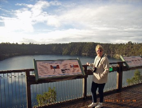
| Blue lake, Mt.
Gambier |
|
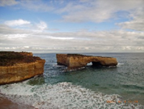
Remains of London Bridge |
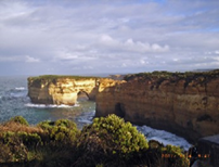
Loch Ard site. Great Ocean Rd. |
|
|
|
|
|
|
|
|
|
|
|
|
|
|
|
|
|
|
|
|
|
|
|
|
|
|
|
|
|
|
|
|
|
|
|
|
|
|
|
|
|
|
|
|
|
|
|
|
|
| Pit stop, mates
place, Melb. |
Lakes Entrance, just before |
Scary section on Barry Way. |
|
| Pity they don't
have XXXX. |
the floods hit and inundated |
One of the TOP three tracks in |
|
|
|
|
the town. |
|
|
Australia. |
|
|
|
|
|
|
|
|
|
|
|
|
|
|
|
|
|
|
|
|
|
|
|
|
|
|
|
|
|
|
|
|
|
|
|
|
|
|
|
|
|
|
|
|
|
|
|
|
|
|
|
| View of Snowy
from Barry Way. |
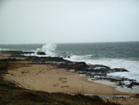
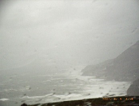
Stormy weather, Stanwell Park. |
Snow on New England hwy mtns. |
|
|
|
|
|
|
|
|
|
|
|
| The savage
weather in early Jun-07 forced us to hurry thru Sydney and Newcastle to avoid
getting |
|
| trapped. We
heard the Pacific Hwy was blocked and waters were rising fast on the New
England. |
|
| After we got
thru Singleton/Maitland, this highway was also closed for some time. Going up
the |
|
|
| escarpment near
Murrurundi, there was extensive snow on the New England peaks beside the
hway. |
|
| We heard a ship
had run aground at Nobbies beach, Newcastle. The way we were being buffeted
by |
|
| the wind, this
did not surprise us. All in all, a good trip, when you allow for and adjust
to any |
|
|
| conditions you
might meet. The Pathfinder performed flawlessly, as usual. No punctures, the |
|
|
| Cooper tyres
are robust and good value. |
|
|
|
|
|
|
| ============================================================================== |
|
|
|
|
|
|
|
|
|
|